
Islamabad was not built randomly. Its master plan was developed in 1960 by Greek architect and urban planner Constantinos A. Doxiadis, with the city designed as a low-density capital surrounded by green spaces and natural landscapes.
Yet more than six decades later, heavy rain can leave parts of the capital underwater. On September 1, the twin cities received an extraordinary amount of rain. Shamsabad recorded around 197–200mm, Golra 157mm and H-8 152–155mm, while Saidpur received nearly 100mm. In Rawalpindi, water in Nullah Lai reached 29 feet at Katarian, forcing evacuations in vulnerable areas.
Rain this intense will challenge any city. But flooding is also about what happens to the water after it hits the ground. As Islamabad has expanded, more land has been covered by roads, buildings and other hard surfaces. This reduces the amount of rainwater that can naturally seep into the ground and increases the volume running toward drains and waterways. Recent research on urban expansion in Pakistan also identifies reduced infiltration and the loss of natural waterways as important factors behind urban flooding.
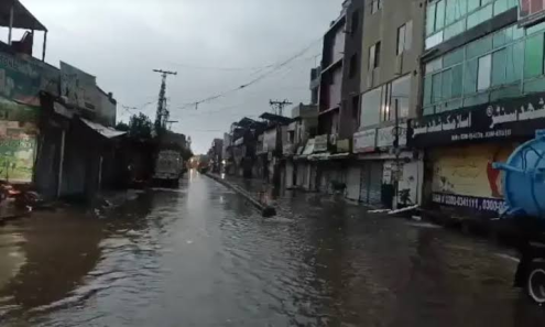
There is another problem: the city Islamabad was designed for is not the city that exists today. Population, construction and traffic have grown, while extreme rainfall can put pressure on infrastructure designed decades ago.
The CDA is now working with JICA on a new water, sewage and drainage master plan looking ahead to 2060.
The real challenge is no longer simply managing the next downpour. It is making sure Islamabad is planned for the climate and population it will face next.